 First anniversary of Hurricane Katrina brings lots of television attention to New Orleans. Probably the best news is that C-SPAN is in New Orleans Monday and Tuesday - with wonderful coverage. Visit their website for a wide range of information resources. Take the time to watch the coverage on today's "Washington Journal," starting at 7:00 A.M. (est) or "Lessons "Learned from Hurricane Katrina" at 1:00 P.M. (est).
Photo left is of Chalmette, Louisiana - September 2005.
Under the heading of GOOD JOB DONE DURING RECOVERY:
- nola.com - website of The New Orleans Times-Picayune
- Louisiana United Disaster Response Ministry - website of a group that enables church volunteers from all over the world to help residents start to rebuild their home. The Rev. Darryl Allen Tate appeared on C-SPAN Monday.
- NOPD - Assistant Superintendent Warren Riley seems to have done a good job of trying to turn around the NOPD from its disastrous performance record at the time of Katrina.
- Metro Hurricane Katrina - the Brookings Institution study of related issues
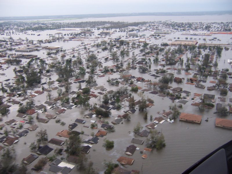
- NOAA images of Hurricane Katrina - lots of richly detailed satellite images of the Gulf coast. These are in the public domain, but credit National Oceanic and Atmospheric Administration.
- neworleans.com - opens with a neat little video of sights and sounds of New Orleans, a rich website with 4 staff listed, in existence since 1995.
- New Orleans Calendar - lots of hotlinks to scheduled events details
- New Orleans Wiki -volunteer maintained collection of articles about NOLA and info about the Rising Tide Conference
Under the heading of a POOR JOB DONE DURING RECOVERY:
- City of New Orleans - an excellent and very modern website that does not reflect the poor job done by the city administration.
- State of Louisiana - official website of LA., the entity most responsible for administering Federal aid to New Orleans. Bureaucracy at its worst.
- U.S. Army Corps of Engineers - near the bottom of the list. It was their levees that failed and let the city drown.
- FEMA.gov - at the bottom of the list, with big grade of "F."
My "creative post" today at Southwest Blogger is a short essay about New Orleans.
1 comment:
I wonder how New Orleans is going to fit all the reporters that are going down there! I think that citizens, even though they are aware the situation down there is dire, are going to be absolutely shocked when they see the lack of progress in the rebuilding and recovery of the Gulf.
Google Earth can help you remember what the Big Easy was like before the storm hit!
Google Earth combines satellite imagery, maps and the power of Google Search to put the world's geographic information at your fingertips. Since the images are photographs taken by satellites and aircraft sometime in the last three years, Google Earth display's Gulf Coast cities, like New Orleans, as they were BEFORE HURRICANE KATRINA.
All you have to do is download the free version of Google Earth, and you can visit Gulf Coast states as they were before the storm. You can stroll along Canal Street and zoom in on the Superdome. You can also visit your own neighborhood and home by simply entering in your address into the Google Earth Search bar. The images are very clear considering a satellite takes the pictures from millions and millions of miles away.
Also, check out my Blogger Call-to-Action: Rebuild the Gulf with Google SketchUp Challenge on my blogsite!
Post a Comment